Sunday, April 28, 2013

I made it to Skye


The Caladonian MacBrayne ferry runs the main services between the mainland and the surrounding islands. For the Small Isles – Eigg, Muck, Rum and Canna – this isn’t necessarily daily, and even if it passes the island you want to set your feet on you might have to wait for it to do the rounds before it makes your stop. In some ways, I imagine that this would mean a little more planning if you lived on the island (I understand there are only eleven inhabitants on one at the moment, and just three on another) because if you missed your ferry that would be it. But in another way it would also give a more relaxed pace for your life. You don’t have eighteen buses for fifteen destinations to do any selection of varied activities to choose from. You’re constrained, and perhaps there’s a freedom in that. This, of course, comes from someone who’s never lived on an island with just one ferry almost daily, and hasn’t actually spoken to anyone about it.


I did catch a ferry for part of its Friday round to two of the Small Isles, Muck and Eigg, just for a cruise to get a closer look at those shapes visible on Mallaig’s horizon, though that hardly makes me an expert. The weather was giving the same mix of rain and sun from the previous day, and the entire journey we passed through shadows and skiffs and sure them in turn chase over the land forms, islands and mainland alike.


‘Eigg’ comes from an old Norse word meaning ‘notch.’ It’s quite apparent how it got this name on looking at it, as the cliffs on the island align in such a way as to produce quite the notch in the island’s silhouette. It was quite impressive to see the notch separate, the thrusting peak of it turn into a long cliff to match that on the other side. We sailed on by the first time of passing, going to Muck where a farm vehicle was loaded on and a couple of people (possibly exactly a couple, but at least one) boarded. Muck was green and comparatively flat to Eigg. Its name apparently means ‘pig.’ Why exactly it’s an island of pigs I’m not sure, and haven’t yet found out. There was much more foot traffic off and on at Eigg, where we stopped long enough for me to watch twin lambs attempted to scale a steep side with their mother’s encouragement. As a side note, it seems that all lambs come in pairs over here.

Some kind of sea flowers
on the beach at Broadford
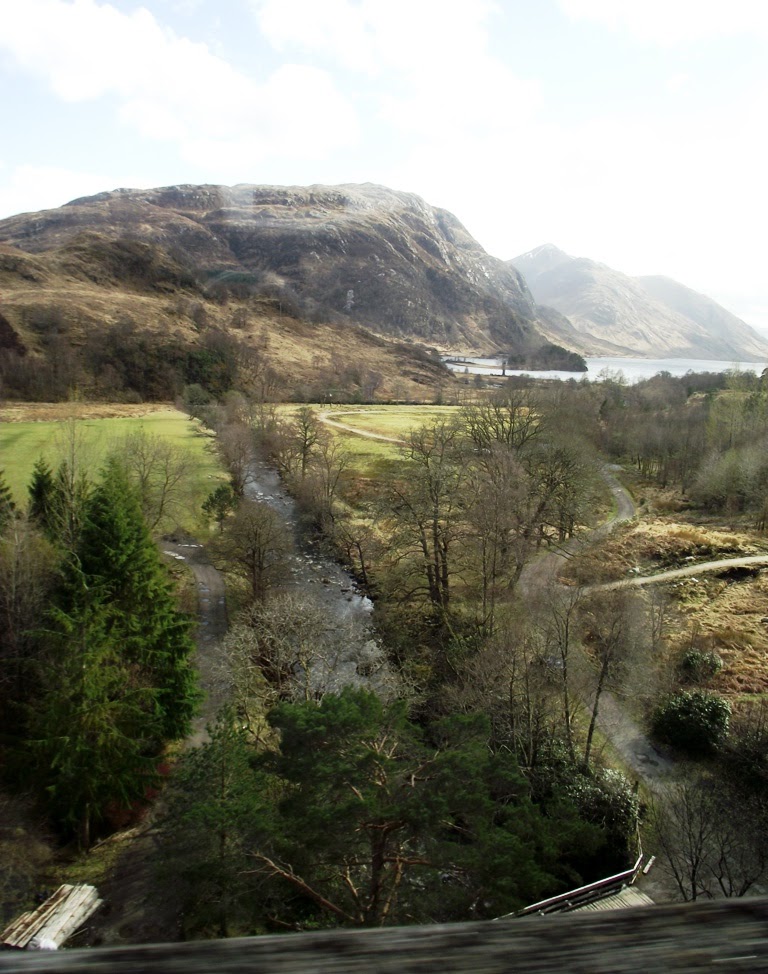
From Eglol pier

We came back to Mallaig, and I exchanged the Congratulations-You-Won letter for my free ticket to Skye, and managed to find a home for the spare with not a hot fisherman as proposed to me by one of the woman, but a somewhat flustered looking chap in the terminal who’d just come from Eigg with an ungainly backpack. On the ferry I took advantage of the discount coupon that came with the ticket, having two biscuits and two hot chocolates to myself. The ride to Armadale was short. Skye is very close - after all, there is a bridge to it on the other end.

Now, I know that some of you are waiting for a description of a marvellous pier on the Isle of Skye, enhanced with the meaningfulness of stepping out onto the island of my ancestors. It was just a pier, with black rock and seaweed, and a bus that had been instructed by the lady who sold me the biscuits to wait. It became more than ‘just’ as we drove on. I saw low rocks jutting out into the sea, sea that cut into the land. I saw big hills I don’t know the names of, green farmland, some forboding moors, and more big hills. There were round hills and pointy hills, hills that seemed to be leaning in on themselves, and even, dare I say, some little hills.

Broadford is small, and somewhere between dull and charming that I can't quite pinpoint, and makes me think of Jethro Tull’s ‘Broadford Bazaar’ and want to learn swear words in Gaelic. It's right on the waterfront, with the ocean enclosed by hills all around, and a couple of small islets over which smears of rainbows like to lurk. Behind it are the peaks of the eastern Cuillins. The beach is pebbles and sand and slabs of broken rock that form a broken grey pavement. There’s a short walkway out to a pier that passes an old cairn that was once accidentally broken to reveal a burial mound, and which now has trees growing over it. In the pine trees behind the backpackers I stayed at, which I simply can’t bring myself to recommend, I found a treehouse with a printed notice pinned beneath it, declaring that someone had built it because it made their heart happy. It also had a more formal notice hammered underneath it, warning not to go up because of the possibility of death (I assume from the possibility of falling).


I had intended to spend to following day biking out to Suisnish, largely because it seemed a ride I could do comfortably within the time and would allow me to see some more of the island. However, I had forgotten to email the bike hire place, and the fellow wasn’t there. Instead I caught a lift with a local woman, who was going to Egol. She’s been a resident of Skye for a couple of years now. She originally came from Sweden and bought a one way ticket to the UK, took any bus, and ended up on Skye. She didn’t leave.

She recommended to me taking a boat out to Loch Coruisk. It can also be reached from land, either on a long walk from Sligachan or a shorter one across the steep and terrifying-looking ‘Bad Step’ from Egol itself. On a boat, you don’t have to walk as far or risk dying quite so much, and you also get to pass by some seals. “I can recommend the white shed,” she said, for there are two companies that offer rides, and the white shed is run by locals. I arrived just in time for the white shed Misty Isles Boat Trips departure. There were just three of us (and the very affable and quite handsome young man piloting the boat). One passenger was, though I try not to seem cruel saying it, somewhat of a caricature – the accent of Moss from ‘The IT Crowd,’ the aged appearance of one of my old University tutors, likely well-travelled and a consumer of travel plans (I expect he knew his train timetables), rather talkative, and a fan of the phrase ‘it’s quite pleasant.’ He was also, let me reassure you, quite friendly.


The drive to Egol was very scenic, taking me past the Red Hills, past the jagged and magnetic Cuillins, and a variety of other hills between. The other surrounding peaks that look over the bay in Egol have names like Bla Bheinn, and only go up. The little boat took us out towards them and into a bay, where seals (of the common variety) lounged and flopped about on the rocks. Their hides are speckled and smooth, not like our fur seals.

Loch Coruisk is out of sight on first landing, but walking around the mouth of a river that emerges here it becomes quickly apparent. It is surrounded by the black Cuillins. At the end of the loch they were covered in snow. Our Edinburgh friend Walter Scott said of the loch,
Rarely human eye has knownA scene so stern as that dread lake,With its dark ledge of barren stone.
I walked as far as I could in half an hours, stopping to gawk at the blacks and greys and heavy blues. I climbed over the sloping rocks. I looked for red deer and sea eagles and saw none, but it didn’t matter. I saw Coruisk. Then I turned back to catch the ship, for we only had an hour allotted. It seems it was timed well, as the clouds began to move in as we left.


The other passenger on the boat was an older man who I rather liked. His brother had once been a sea merchant, but was ejected from his homeland for some misdemeanour or other and had resolved the situation by marrying a Maori woman in New Zealand, and so he has family who live in the Bay of Plenty. He had been travelling there, and said that it had been one of the few places he’d visited that had tempted him at all to move. He also turned out to be a writer, mainly of short stories, and so we conversed a little on the matter. He was able to give me a lift back to Broadford. It was by far the best company I’ve met so far.

 Things like that day to Egol are what I had hoped – chance, fate, aventure.


Friday, April 26, 2013

Glencoe - Mallaig

In this part of the world, rainbows emerge directly from the ground and the hills are all made of time.

I'm sitting in a dining room surrounded by photographs of lochs, islands, and highland cattle. The walls are as green and blue as a badly-decorated Sims house, and you really don't want to spend very long in the kitchen. Behind me is a small pine forest containing a tree house (marked with a warning about death from falls), and outside is, occasionally, rain. There's been rain like this, drifts that suddenly come and suddenly clear into stunning sunlight, over the last few days in the places I've been. I'm in Broadford. I'll tell you about that later.
 

View from Glencoe Visitor Centre


Glencoe gave me more rain than sun. I wasn't sure if I ought to change my plans at first, but I knew I'd regret not going, and I was already walking down the hill with a German girl from my room who was catching a train at the same time as my bus (8.45; she was going to Windemere via Glasgow, a nice 3 hour stop for her in uugh).

The road between the little village and Fort William runs along the edge of the water with hills and mountains on the opposite (and, often, the same) side, but all I could really see were gloomy possibilities within the low cloud and steel grey water with lashes of white striping the surface.

From the visitor's centre, just a little beyond the village, I got the start of a sense of what it is that makes Glencoe such a popular site for scenery lovers - the centre and caravan park is surrounded by close, tall, and steep heights of land with rock and snow. The cloud covering their peaks gave something of an ominous air to it. I had all my gear with me, and with them and the rain combining powers didn't want to try any real walking, so instead wandered through the little forest around the centre and then went in and had a look at their exhibition. It showed a documentary about the massacre, about which I didn't know very much. Rather than just a clan dispute, it was commanded on government orders to try and crush the 'rebellious' MacDonalds - whose representative had already gone out of his way to sign the required documents of peace. Walking to the village I passed the ruined stone walls of one of the houses that was reputedly destroyed in the massacre, though rumours say that one boy lived, for his assailant couldn't face murdering a pleading child.


It was only as I was leaving that the weather began to clear, first for just a moment while I was sitting in the Glencoe Hotel with a hot chocolate, and then as I was returning on the bus. Then I really understood what it is that draws people to Glencoe, and saw what I'd hoped to find. I can't describe the hills very well. I've described lots of landscapes already, often ineffectually. I have no pictures to give you, because they rarely look good through a window, and even if I did have them I don't believe they could convey what it was like. It was better than anything I saw in Fort William. It is extreme and contrasting, with the breaching hills and the low flat lochs, with the sudden rain and the bursting sun. I'll go back, one day, and I'll walk there.

I had a wait of too long in Fort William, as I wanted to catch the train rather than the bus up to Mallaig. It rained. I wandered aimlessly, and saw a dead sheep or some other such creature tucked up on the rocks of the waterfront, as though someone had just thrown a damp sheepskin over a stone. I got quite wet, then gave up and sat in the train station to read some more of 'The Three Musketeers' and devour a small block of chocolate.

The train to Mallaig redeemed any disappointment in the waiting - it was the best scenery so far. It was similar in some regards to Glencoe, the same kind of hills, though not as big and with more valleys. The Glenfinnan viaduct is perhaps the best example, looking out over an incredible valley and loch and the famous monument - and for any Harry Potters fans, the spot has Harry connections, including the famous bridge over which the train took me. Coming into Morar the train gave glimpses of the ocean with the sun pouring out across it. We passed wild deer, and got glimpses of the beaches that the area is known for. 


And Mallaig, Mallaig - it is beautiful. A small town at the base of hills and scaling up the sides a little, and with an incredible view overlooking the small isles and Skye. I could see the rain above them like clouds pulled down with a swipe of a hand. I could see it moving across, and then coming in - it hit me on a walk above the little town, and turned to hail, which I caught on my green glove and ate. It tasted furry. A rainbow came out of the ground and reached up out of a little valley right in front of me, and I wandered back down through expensive houses with one of the most incredible views. I had dinner in a restaurant called the Cornerstone, which had a view of the hills on the other side of the small harbour. While I ate fish and chips and drank a little Famous Grouse (the Scottish waitress had to check I'd said 'grouse,' my accent is so odd), it rained again and a double rainbow came out.

The small isles from a carkpark in Mallaig

There were two women who had been on the same train and me and were staying in the same place (Sheena's Backpackers or Mallaig Backpackers or the back and upstairs part of The Tea Garden that was tricky to find). One of them had won train tickets and tickets over Skye, and I was surprised and grateful when I was offered the tickets for the ferry. They had enough time to spend a night in Mallaig, but had to return the next day. I think we all found the backpackers a little odd - it was a very nice place, warm and clean and with two spacious wet rooms instead of pokey little showers, but there was no lock to the door or place to store our things, and we were shown the room and abandoned to work things out for ourselves. But the showers were very nice, and the beds were comfortable enough and I slept well.


Wednesday, April 24, 2013

Getting to Fort William

Advice to travellers: Glasgow has several train stations. If you need to catch a connecting train, make sure to get the connecting bus over to the correct station for your transfer. There are probably signs somewhere telling you this. If not, the lady will tell you where the station is and you can try running to it through strange streets with very tall buildings.

If you miss your connecting train, buy another ticket to Fort William for the following day and spend the night in your very own expensive, quiet room with a big bed and four pillows and a bath tub from which you can view the television while it shows you images of natural perfume makers and seaweed baths in Ireland. And also man-eating sharks, and musth-enraged bull elephants on killing sprees. Then sprawl out in bed, beneath the giant picture of lavender, and go to sleep. The next morning, catch a train to Fort William, a somewhat small town but one of the largest (second, I believe, only to Inverness) in the Highlands.


Glasglow is rather dull looking, and the landscape leaving was nothing special. I fell into a doze and was awakened by Ian Anderson doing something particularly boisterous, just in time to catch the start of some spectacular scenery - for the train line goes right through the highlands. You move through the hills and over the edges of them, past grey stormy lochs, stretches of purple heather, rocks. We passed through grey rain and bursts of incredible sunlight, with the shadows always shifting on the hill faces.

I was secretly afraid that I wasn't going to like it. I was worried that my 'Southerner' aspect, as someone put it, wouldn't go well with the Highlands, and that rugged hills and open spaces would appall and threaten me. Didn't happen. There is a marked lack of bush, but there are forests, and there are dark and paler rocks both and low shrubs that here look in place, and there are the spectacular formations of the hills and mountains everywhere. It feels like a landscape where things have happened, and can happen.

A big mountain


And I haven't yet mentioned the loch and rivers, which Fort William and several of the surrounding little settlements are based around. Fort William is one end of the Great Glen Way, a fault line that can be walked, marked by the characteristic long stretches of water that go horizontally across Scotland all the way to Inverness. Fort William is beside Loch Linne, a sea loch. I could smell the salt when I walked down along the water's edge, though it doesn't smell of the ocean all the time. The rivers that flow there move fast, but not so fast that otters can't enjoy it - I've seen two of them playing in the water together in the late afternoon twice, their heads dipping out and their broad tails splashing as they dove down.


All this water is the reason for both the fort that gave the place its name, and for Inverlochy Castle. Both the fort and castle are in ruins, although the castle has fared much better. It may now be hollow, but the four towers are still standing with signs of the three levels, and the walls are a little broken but all there. They are very thick and heavy-looking. Signs of the old moat are still there, and once the river ran right up to the edge of it for defense. The fort was built on the waterfront for the same reason, initially by Ol-i-ver Crom-well (Lord Protector of England, Puritan) and then was used in the suppression of those darned Jacobites. Unfortunately, the land eventually had a railway station slapped through the middle of it, but the edge of the fort wall can still be seen on the waterfront, and the site of that end of the fort is still apparent. Informative billboards and daffodils cover the stretch of gorgeous green grass, and it so happens that the Great Glen Way officially ends here.

Inverlochy Castle

Braveheart Carpark

Today I went on a couple of the walks that can be done in the hills and forests. Ben Nevis has a lot of snow on it, and looks too big for a short stay in Fort William, but perhaps another time I will venture. Perhaps. I walked instead down to Glen Nevis, and found myself a route to take from the Braveheart Carpark - so named as they filmed some of that wonderful historically accurate film there. I walked up to the site of an old fort called Dun Deardail but not pronounced that way, which took me up through forest and the side of a hill with a fantastic view of Ben and the town and glen below, and pretty much everything else. There's little left of that old fort, including knowledge of its definite history, but the outline of it can be seen on the top of a rise with stones in the ground. The fort was burned down, melting some of the stone together, and surely being the cause for its abandonment, but who burned it down and why is a mystery. There are lots of small waterfalls along the pathway, and lots of moss growing up underneath trees, thick and springy. It reminded me, just a little, of some of the tracks in the Kaweka ranges in Hawke's Bay, half- (and possibly mis-) remembered from childhood, though there is nothing of the stretch of history involved in either habitation or the actual land itself as in Scotland.


I also walked the Cow Hill track, taking me through some steep and delightful forest, then eventually breaking forth into open spaces on the hills. The shadows moving across the land were, again, amazing. Walking up to the summit of Cow Hill I encountered some proper Scottish Highland cattle, introduced to the forest area to try and help reestablish it, for once these fine beasts ran free and added to the diversity of the area. I also had yet another fantastic view. But where doesn't have a fantastic view? Even my bunk bed, when I open the curtains, has a fantastic view.


On my way back I encountered a wild doe, who hesitated long enough for me to take one quick photo before bouncing onwards with a bob of white the only distinguisher and it moved into the trees, and a friendly elderly lady who hesitated long enough to chat with me about Sir Edmund Hillary and New Zealand's rugged landscape. She thought that travelling alone has its advantages, as does cooking dinner. "'Oh, it's all right,' he'll say, and you've been slaving away for hours." It was just her and her two dogs, now. One of her dogs was quite beautiful.

I've been staying at Fort William Backpackers, and can recommend it. The staff there very friendly, and at least one of them (the Irish one) is very... full of energy. It's also a nice building, and is on the hill up above the town and the loch, and with Ben Nevis in view from the right angle. It also has a chap who was an extra in the movie 'Highlander' - Christopher Lambert does not like horses, the American woman who played Heather was nice enough, and the chap who played the Kurgen is good value and has a brilliant sense of humour.

Tomorrow I'm going to Glencoe, if things go according to plan, and then will be heading up north. Before I finish up this long post for tonight, I would just like to reiterate that I have seen otters, wild otters. I was filled with delight. The doe was also wonderful - if she'd stayed where she was she'd have been invisible to me, but instead she decided to run up away from the fence and pathway into the 'shelter' of the bare trees. She blended into the land well.


Huh?


Tuesday, April 23, 2013

Rambling


York has proved a good base for my rambling. It’s relatively central, if you want to go to Edinburgh and London, and there are lots of day trips you can make out from it by train or bus. It’s also a nice city in itself and there’s plenty to do, and it's early spring.

Wild racoons, driven to angst by the scent of spring, ravage York

The Jorvik Centre stands in testament to the brilliant Viking remains uncovered in the city centre itself, and includes a little glass-covered segment of the site that one can even walk upon. There is also a short ride in a suspended pod through a reconstructed village where some of the plastic people talk to you in their language (thank god for the helpful guide voice and her translation skills). The artefacts there are also very interesting, not quite so plentiful or well-marked as those in the National Museum of Scotland, but still worth a good peruse, and there is someone (occasionally dressed in a Viking costume) manning a desk who will personally tell you about items if you point at them. Somewhat similar, though less interesting, is the Barley House. This medieval building was discovered beneath a more modern covering, and has now been turned into a kind of museum oriented particularly for children. It sports a jaunty song about getting the plague. There are, of course, many food dispensing buildings with variations on the chocolate theme – after all, York is considered by York to be the home of chocolate. I had a delicious chocolate, honey and lavender fondue to complete my lunch (a selection of delicious pork, including black pudding) one afternoon and thought I would drown from the richness.


Birdhouses, or batboxes?

I’ll add to that handguide summary a path up the Ouse. There are paved paths some of the way, as it’s part of a cycleway, but there is also a right of way that follows the river almost directly. I passed some birdhouses in a small stand of trees, found daffodils, a very green paddock where the Vikings once were, a murder of crows clattering around their nests, robins, the houses and private jetties of rich people on the opposite bank. I walked along the edge of a paddock where sheep looked expectantly to me, and where lambs leapt around next door. I saw a multitude of mole hills, and my first English rabbit. Then I walked back. I was pretty hungry.

While in the Yorkshire area, it’s almost obligatory to see at least some of the dales and the moors. The bus to Whitby went through the northern moors, big expanses of strangely flat rises with an uninviting purple shade pressed into them. I went for a walk in the dales, which in parts had some of the same semi-alien quality as the moors, but much less so. The ground was green, as much of it is farmed, and the hills seemed a more recognisable shape.


My plan for my dales adventure was to walk from Ribblehead (hehehe ribble), which turned out to be a small stop in a somewhat uninviting area with only an Inn to tide it over, to Horton-in-Ribblesdale (HEHEHE), which turned out to be quite otherwise, by means of the summit of Ingleborough. The dales are big, which I got a strong sense of immediately I got off the train. It’s only the peaks that are the real landmarks – everything is farm with long stone walls trailing up and down and across. The dales are big. You wouldn’t want to get lost in them. Imagine that. How silly would you have to be to get lost in the dales.

I had a map, but it may be that perhaps it wasn’t entirely clear on how to get to the initial walk, and it may be that I ended up skulking through what probably wasn’t parkland, scrambling up a ledge of limestone, leaping down over a stone fence topped with barbed wire and landing miraculously on my feet like some madskill ninja, then scaling sideways over the hill to get to the path which I then somehow abandoned by accident, and thereafter abandoned my initial plan to conquer Ingleborough. Instead, after playfully standing in a hole and deliberately filling my shoes and socks with water, I found my way back down off the hill and followed the paths as they were marked by posts or tracks. There were still patches of snow sitting in sheltered places, dips in the ground or against walls. It felt exactly like New Zealand snow, all crunchy and yuck. The wind was chilly.

Again, I found it disconcerting to be walking through what was farmland at least some of the time. Even when I was standing underneath signposts, the presence of cattle or sheep made me feel guilty, and there was nowhere to take shelter should an angry farmer come out and yell at me for trespassing. There were a few other walkers I passed though, and I consoled myself that none of them appeared to have been shot.

It’s difficult to say what the most remarkable thing about the dales (or, the part of them that I saw) is – the vast and bare expanse of them, or the stretches of limestone. The form of the land is very impressive, and I think the emptiness of it emphasises that. The different peaks, including Ingleborough, may not be real mountains, but they are high enough to feel important without overwhelming you like a gnat in a basin. You can see the stone walls dividing it up in sections.

The limestone was, in some respects, more impressive. It’s in the stone walls of course, shards of the stuff piled up on top of itself with a line of barbed wire just for good measure. There are little places here and there where holes in the ground are apparent, lined with the pale limestone. Some have shallow cave-like gaps where you could probably crawl if you were hard-pressed for shelter, though I’d be worried of my foot slipping and catching in an unseen crack. Some of the stone itself was cracked, almost like you could pull the top off it if you tried. It had been weathered and sculpted, with dips and curves, like little islands on a sea of hardy grass. Some, I thought, even looked a little bit like New Zealand, maybe.


As I headed onwards, I came across some very big expanses of the stone, grey and stretched out along the ground. This was the truly alien part of the landscape. The stone almost seemed alive, and it was a little alarming to suddenly drop from a rise, or to look down into a valley, and find it sitting there like a colony of tight-knit creatures watching your every move. If you acted suspiciously you could feel them ruffle and nudge each other, and the air grew thicker while they waited to see what you were going to do.


What I did was walk on down a right of way through clear farmland, disturbing some ewes with their wee lambies, and emerge at the Horton-in- Ribblesdale train station above the township. And what a township it is. If you have ever seen a picture of an idyllic rural English village, you may begin to have some idea. The sun had come out entirely for the afternoon. It was golden and thick on the green paddocks, real honest-to-god green. It gave the giant hill of Pen-y-ghent that the village sits beneath a doting parent quality. Two waterways converge and run beneath a pedestrian bridge, with a wooden seat beside it, and a little paddock of sheep and chickens before it. I think that the last few hours, just wandering and sitting on that seat in Horton-in-Ribblesdale, were the best part of the day.


I have seen bats, flickering around the river as darkness comes down. They move like giant butterflies, and click. No foxes yet. No puffins. 

To find out what exciting animal I have recently seen, tune in for the next instalment, based in Fort William, Scotland. And look at this sunset from York in the meantime:


Sunday, April 21, 2013

Whitby

In 1987, the Demeter was caught in a storm, running aground on the coastline of the small town of Whitby, England. It was a misty, eerie time. Rumours of a strange dog circulated. Shortly afterwards, a pure young woman recently engaged to one of three options was defiled and drained of her blood. Another pure woman, if more worldly and pragmatic, saved England from an ancient vampire with her extensive knowledge of train timetables.

But there are no trains to Whitby. Instead one must study the bus timetables, and catch an early bus from the York train station and be sure to catch the one just before six (change in Malton), or else be stranded on the Gothic shores of the little township, for it is the last bus of the day.

Whitby Abbey, providing Gothic inspiration since 1897

There is a little gimmicky museum dedicated to Bram Stoker's creation. I didn't go in. Too much black plastic in the doorway. I ate fish and chips instead at the Magpie Cafe - a piece of fish so large that it refused to fit on my plate and at first I thought it was the most delicious piece of battered piece of dugong flipper n in the world, with a side of mushy peas. I wasn't expecting to like the mushy peas, but I thought I ought to have them as they seem a stock part of your English fish and chip meal. They were, luckily, also very delicious. I suppose the difference between the mushy peas I've eaten before and these was that these peas were deliberately mushy. The Magpie Cafe's culinary ability may also have contributed. I even tried Jessie's mussels, and found them to be not disgusting.


Whitby Abbey is, of course, one of the most obvious things on the skyline and possibly the key attraction of the area, unless you enjoy Goth-spotting when the Goth season comes around. To get into the abbey, you have to pass first through a graveyard where your friend won't let you lie on the stone tablets like Aslan, and then through a pretend museum which displays some unsettling gargoyle faces and allows you to make crayon rubbings of medieval designs and fonts. Unfortunately, a whole bunch of kids had been through before us and used up most of the paper, but we managed to find a few more bits and use up the rest. I have quite a nice rubbing in teal blue of a medieval lettering plate.


The sea salt in the air seems to have contributed to the patterned erosion of the old abbey, exposing the grain that runs in different directions on individual stones, showing off the pale gold-brown beneath the old grey surface. The detailed columns up in the high windows have been nibbled at by time. The Abbey changes shape depending on where you're standing. Sometimes it looks long and broad, sometimes shallow and squat, sometimes as though it was only ever a single wall. From a distance, it looks like a simple cardboard cutout in a pop-up book.

I found this out walking along a pathway at the edge of the cliffs, down through the eye-sore of a caravan park, and at last down onto a small bay. The sand was quite firm and peppered with smoothed stones, including some black ones that can be broken apart in flakes to reveal - if you're lucky - small shells compressed and fossilised between the layers. We sat on a rock and did this for a while. I wasn't very good at it. I enjoyed snapping the rocks in half, and feeling them crumble into thin chunks in my hand. The little beach was empty, and we stayed there for a little while, walking up to the rocks where water had pooled as the tide rolled out, watching the waves. We found a thin waterfall as well, falling down the cliffs over damp weed and cutting down into the sand and out to the sea.


The cafe of chocolate lumpy bumpy
Despite the rumours, Whitby didn't strike me as a particularly Gothic town - although I did get another of those sunny days that have so far accompanied my visitation of ruins. Maybe on a darker day when the fog rolls up from the sea, or the weekend of the Goth festival, things would have been different. But it simply seemed a charming little town where families can enjoy the beach on weekends and fisherman can take you out on their ships to practice your own skills - for a price. It has quaint cafes with delicious cakes with names like "chocolate lumpy bumpy," botiquey jewellery stores lined with silver and the black jet Whitby is famous for, and people walking their small yappy dogs. It has a polar bear standing inexplicably on a building just beyond the bridge, a monument to born-'n-bred James Cook.

Captain James Cook and his Seafaring Chopsticks

Up on the hill, the graveyard and the abbey may be looking down, but they don't dominate the town. If anything, I think the ocean does. It is the ocean, after all, that you notice as you drive down the windy roads after emerging from the purple moors, that you can smell when you walk down the streets. It was the sea that gave the town its purpose, that Captain Cook took on his oceanic endeavours, that helped to groove the old abbey on the hill, that brought Dracula to the shores of England and the end of his ambitions.

Pensive over Whitby